Wo liegt der Salda-See?
Der Salda-See liegt bei etwa 37,5500° N, 29,6833° O, im Bezirk Yeşilova der Provinz Burdur, Teil der Mittelmeerregion der Türkei. Er befindet sich in einer tektonischen Senke, umgeben von kiefernbewachsenen Hügeln, etwa gleich weit von Denizli und Isparta entfernt – beide rund 1,5 Stunden Fahrzeit – und etwa 45 bis 60 Minuten von der Stadt Burdur selbst. Diese Binnenlage etwas abseits der ausgetretenen Pfade ist mit ein Grund, warum der See einen ruhigeren Charakter bewahrt hat als stärker erschlossene nahe gelegene Attraktionen.
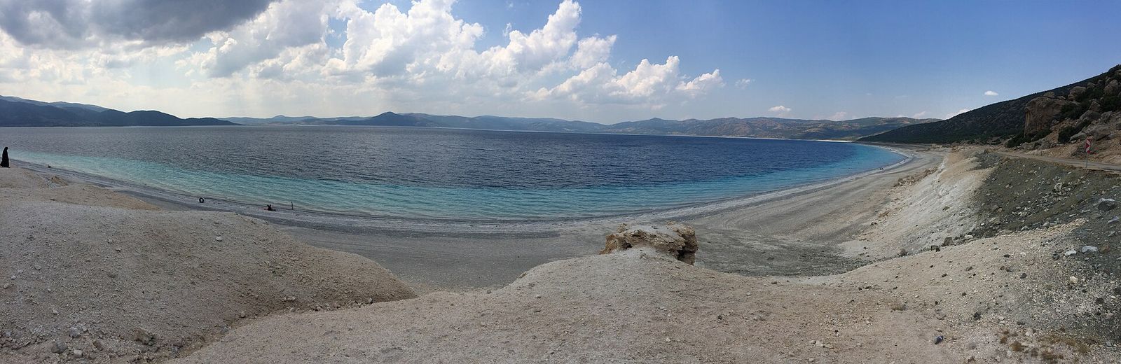
Aufbau des Sees
Das Ufer des Salda-Sees ist nicht einheitlich – verschiedene Abschnitte dienen unterschiedlichen Zwecken, und die allgemeine Anordnung zu kennen, hilft bei der Planung, wohin Sie nach Ankunft gehen:
- Hauptöffentlicher Strand (nahe Yeşilova) – der primäre Zugangspunkt mit Parkplätzen, der unkompliziertesten Anfahrtsstraße und der ausgewiesenen Schwimmzone, die die meisten Besucher nutzen.
- Bereich Beyaz Adalar (Weiße Inseln) – der visuell eindrucksvollste Abschnitt reinen weißen Hydromagnesit-Ufers, vor Fußverkehr geschützt und am besten aus respektvollem Abstand statt direkt betreten zu betrachten.
- Ruhigere Buchten – kleinere Abschnitte weißen Ufers, zu Fuß vom Hauptstrand erreichbar, und eine ruhigere Alternative während geschäftiger Zeiten.
- Ausgewiesene Campingzonen – zurückgesetzt von den empfindlichsten Strandabschnitten, für Übernachtungen genutzt (siehe unseren Camping-Leitfaden für Details).
Für mehr darüber, welche dieser Bereiche zum Schwimmen offen und welche streng geschützt sind, siehe unseren Leitfaden zu den weißen Stränden.
Wie die Straßen zusammenlaufen
Die meisten Routen zum Salda-See führen durch Yeşilova, die nächstgelegene Bezirksstadt, bevor eine kurze letzte Strecke zum See selbst folgt. Von dort:
| Route | Ungefähre Distanz/Zeit |
|---|---|
| Denizli / Pamukkale → Salda-See | 1,5–2 Stunden |
| Isparta → Salda-See | ~1,5 Stunden |
| Stadt Burdur → Salda-See | 45–60 Minuten |
| Antalya → Salda-See | 2,5–3 Stunden |
Die Straßen sind bis Yeşilova im Allgemeinen asphaltiert und gut beschildert, wobei die letzte Anfahrt zum Hauptstrand klar markiert ist. Für eine vollständige Aufschlüsselung der Transportoptionen – Flüge, Fahren und Busse – siehe unseren Leitfaden Anreise.
Orientierung nach Ankunft
Die gerundete Beckenform des Sees bedeutet, dass der Hauptstrand, der geschützte Bereich der weißen Inseln und die ruhigeren Buchten von verschiedenen Punkten rund um das Ufer aus sichtbar sind, was es leicht macht, sich schnell zu orientieren. Parkplätze konzentrieren sich nahe dem Hauptöffentlichen Strand, und von hier aus beginnen die meisten Wanderrouten entlang des zugänglichen Ufers. Wenn Sie einen Salda-See-Stopp mit Pamukkale kombinieren, beachten Sie, dass beide Stätten weit genug auseinander liegen, dass Sie sie als separate Stopps an verschiedenen Tagen behandeln möchten, oder als einen einzigen langen Tag mit frühem Start.
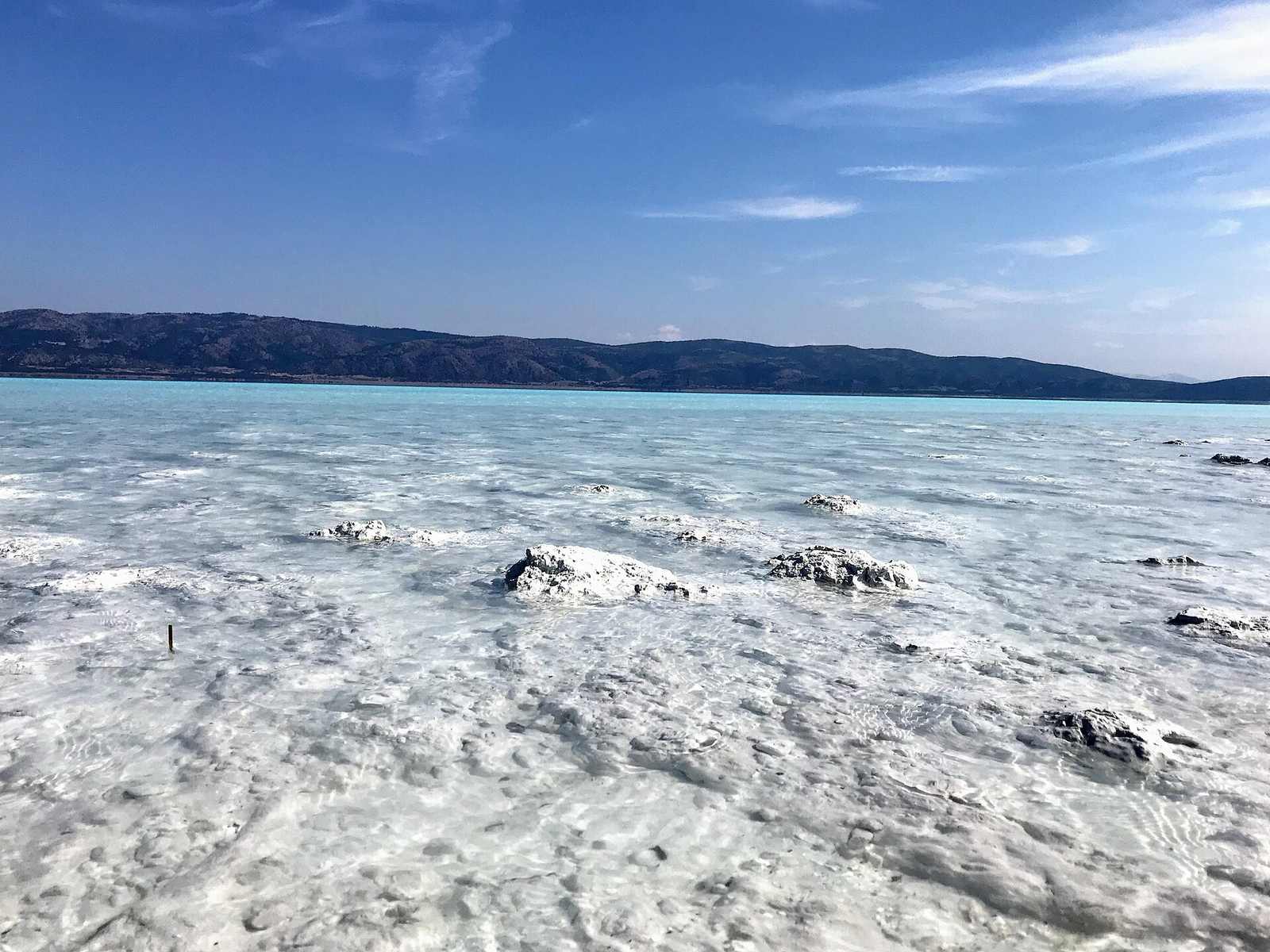
Nahe gelegene Bezugspunkte
- Stadt Yeşilova – die dem See nächstgelegene Stadt, mit grundlegenden Dienstleistungen und der nächsten Gästehausunterkunft.
- Stadt Burdur – die Provinzhauptstadt, rund 45–60 Minuten entfernt, mit einer breiteren Hotelauswahl (siehe Hotels in der Nähe des Salda-Sees).
- Denizli / Pamukkale – rund 1,5–2 Stunden entfernt, eine übliche Kombination für eine mehrtägige südwesttürkische Reise.
- Isparta – eine ähnliche Entfernung wie Denizli, nützlich bei Anreise über den Flughafen Isparta Süleyman Demirel.
GPS und Offline-Karten nutzen
Da die letzte Strecke der Straße zum Salda-See durch ländliches Burdur-Gebiet führt, kann der Mobilfunkempfang stellenweise unregelmäßig sein. Es lohnt sich, eine Offline-Karte des Gebiets Yeşilova und Burdur herunterzuladen, bevor Sie aufbrechen, besonders wenn Sie einen Mietwagen ohne lokale SIM-Karte fahren. Die Suche nach "Salda Gölü" oder "Lake Salda" in den meisten Kartierungs-Apps führt Sie korrekt zur Zufahrtsstraße des Hauptöffentlichen Strands, prüfen Sie jedoch, dass Sie zum Hauptstrand und nicht zu einem privaten oder eingeschränkten Zugangspunkt geführt werden, da einige inoffizielle Pfade näher am Ufer von der Hauptstraße abzweigen.
Distanzen auf einen Blick
Zur schnellen Reiseplanung finden Sie hier eine Zusammenfassung der Kontextdistanzen neben den zuvor behandelten Fahrdistanzen:
| Wahrzeichen | Distanz vom Salda-See |
|---|---|
| Stadtzentrum Yeşilova | ~10–15 Minuten mit dem Auto |
| Stadt Burdur | 45–60 Minuten mit dem Auto |
| Denizli / Pamukkale | 1,5–2 Stunden mit dem Auto |
| Stadt Isparta | ~1,5 Stunden mit dem Auto |
| Flughafen Denizli Çardak (DNZ) | ~1,5 Stunden mit dem Auto |
| Flughafen Isparta Süleyman Demirel (ISE) | ~1,5 Stunden mit dem Auto |
Saisonale Zugangshinweise
Der Straßenzugang zum Salda-See ist ganzjährig generell zuverlässig, da die Hauptrouten durch Yeşilova asphaltiert und gepflegt sind. Im Winter kann gelegentlicher Schnee in den umliegenden Hügeln die Fahrt auf ländlichen Nebenstraßen verlangsamen, es lohnt sich also, die Bedingungen vor Ort zu prüfen, wenn Sie außerhalb der Sommersaison reisen. Während geschäftiger Sommerwochenenden kann der Parkbereich nahe dem Hauptstrand bis zum späten Vormittag seine Kapazität erreichen, weshalb eine frühere Ankunft am Tag – oder ein Blick in den Leitfaden zur besten Reisezeit für weniger überlaufene Zeitfenster – für einen reibungsloseren Besuch sorgt.
Sobald Sie den Aufbau kennen, planen Sie den Rest Ihres Besuchs mit unseren Leitfäden zur besten Reisezeit und Was tun am Salda-See.